Start fishing better with FREE Weekly Video Tips delivered straight to your email.
altimetry
-
Featured
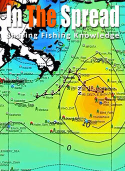
2019, How Altimetry Charts Improve Fishing Forecast
Temperature and chlorophyll satellites show surface conditions but miss the vertical water movements driving productivity. Tom Hilton explains how altimetry reveals upwelling bringing nutrients from depth versus downwelling pulling them away, why upwelling edges outperform centers for predator positioning, and what sea surface height variations indicate about food chain sustainability.
WATCH NOW -
2025, Advanced Fishing Forecast Tips and Tools
Modern fishing forecasts combine satellite data with environmental conditions to predict prime fishing opportunities. Learn how to interpret sea temperatures, chlorophyll levels, and weather patterns to locate fish more efficiently and transform your angling success with techniques once available only to commercial fishermen.
READ MORE -
2025, Best App for Offshore Fishing
Modern offshore fishing has evolved beyond intuition to embrace technology that transforms vast oceans into detailed maps. Our comprehensive guide examines four best apps for offshore fishing—BigBlue, FishTrack, RipCharts, and SatFish—that provide real-time oceanographic data, helping anglers locate productive fishing grounds while saving time, fuel, and frustration.
READ MORE -
2024, Satellite Mapping Services for Offshore Fishing: A Comparison
Modern offshore fishing has been revolutionized by satellite-derived mapping services that provide real-time oceanographic data. This comprehensive guide analyzes five leading services—ROFFS, SiriusXM Marine, Hilton's Realtime Navigator, SatFish, and RipCharts—comparing their features, costs, and effectiveness for both recreational and professional anglers.
READ MORE -
2024, Satellite Fishing Maps - What to Know Before You Go
Modern satellite technology has revolutionized offshore fishing, giving anglers unprecedented tools to locate and catch more fish. By understanding sea surface temperatures, chlorophyll levels, and temperature breaks, you can dramatically increase your success rate while reducing fuel costs. This comprehensive guide shows you how to harness satellite data for better fishing results.
READ MORE -
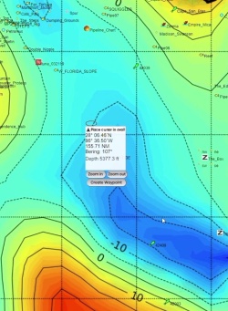
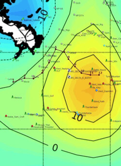
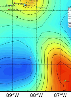
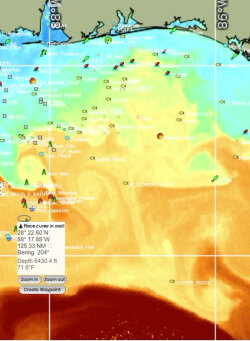
2023, Upwelling and Altimetry Maps for Sport Fishing
Altimetry maps and ocean forecasts reveal hidden upwelling hotspots prime for sport fishing, if you know where to look. Master reading the map's data, and a bounty of tuna, marlin and other giants of the deep await.
READ MORE -
2023, Altimetry - How to Improve Offshore Fishing
Altimetry data can enhance fishermen's fishing activities by providing information on sea surface height, which can be used to predict oceanographic conditions that directly affect the distribution and abundance of marine life.
READ MORE -
2020, Fishing Temperature Charts: Complete Guide to SST Data for Offshore Success
Sea surface temperature analysis eliminates guesswork in offshore fishing by revealing where target species concentrate along thermal boundaries. Learn to interpret SST charts, identify productive temperature breaks, and position yourself where fish aggregate before competitors arrive.
READ MORE -
2020, How to Use Altimetry Fishing Charts and Satellite Maps
Satellite altimetry technology transforms offshore fishing by revealing underwater current patterns invisible to traditional methods. Anglers using this scientific approach consistently locate productive upwelling zones where game fish concentrate, achieving higher catch rates and significant fuel savings.
READ MORE